Services
Parking Lot & Property Evaluations
ACE is a company that specializes in using drone technology and boots on the ground strategy, paired with extensive parking lot and property documenting experience.
We provide detailed maps and easy to understand assessments with photo reports so you can see exactly what your property looks like without having to leave your chair.
Perfect for General Contractors, Property Management groups, Engineering Firms, and anyone who needs to see the state of their property and assess possible damage. We offer recommendations for areas of repair and let you know levels of severity.
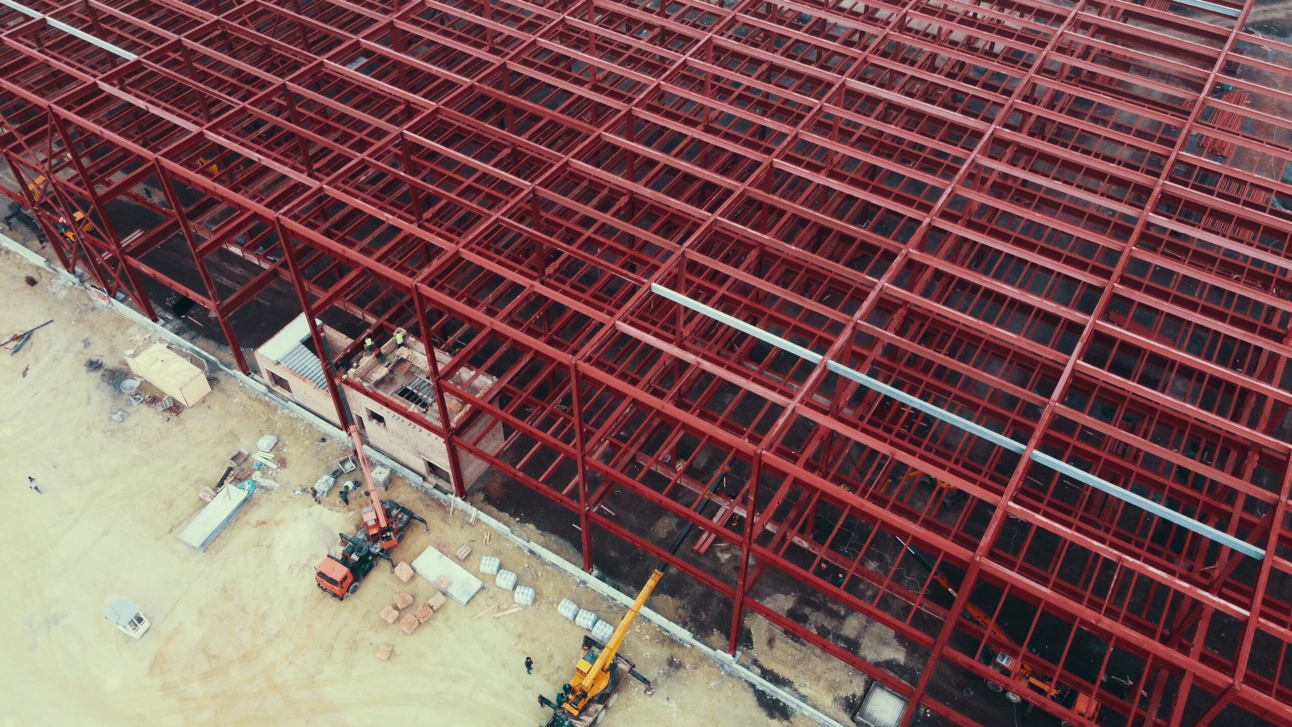
Construction Progress
We understand the love of taking nothing to something, and we want to capture it and celebrate with you. We offer weekly and/or monthly progress photos and videos so you can see an unbiased view of your projects and laydown yards to check for good housekeeping and accurate construction. Save your Manpower with ACE!
Drone Mapping
When it comes to providing usable data to Engineers and Property Owners, we break out the GNSS Receivers and we get exact. Getting real elevations and putting them into models. This leads to topographic maps, stockpile measurements, and a lot more. ACE can now be accurate with centimeter-level precision.
Inspections
Take advantage of drone technology to see the hard to see. We can easily fly waypoint missions with programmable photo capture for projects spanning many acres. We can fly industrial and commercial rooftops and provide you with a highly detailed composition so you can see a complete view of a large, but important area of construction and property management, all done in a safer way.
Why are you zooming in on your photos just to try and see work-in-place that’s happening vertically like building expansions, skyscrapers, and towers? Once the scaffolding comes down, how will you ever be able see those exterior elements up close and personal again? How can you truly inspect them on a regular basis? ACE can.
Coming Soon
ACE is excited to deploy additional drone services in the near future to expand across more industries. Here is what is on our horizon.
- Thermal Imaging for Solar Panel & Roof Inspections
- Mapping & 3D Modeling to give Builders and Engineers more foresight
- Agricultural Drone Applications such as Crop Inspection